← Back to home

GPS tracking during an outing

Updated on 2026-11-01

For:Musher guide

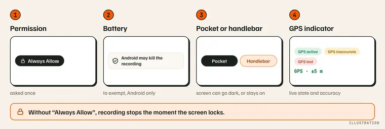
Map of the GPS tracking during an outing page in four boxes: the “Always Allow” permission, the battery on Android, Pocket or Handlebar, the GPS indicator; without “Always Allow”, recording stops the moment the screen locks. Illustration.

Before your first outing: “Always Allow” and the battery on Android

Without “Always Allow”, recording stops the moment the screen locks.

  • “Always Allow” location (“Allow all the time” on Android): MushMate then records your track with the screen off or the phone in a pocket. The prompt appears once, before your first outing or race.
  • Android: also exempt the app from battery optimization (Manage › Account and device › “Android may kill the recording”) so a multi-day race records without interruption.
  • Check everything at once: Manage › Account and device › This phone › “Check my phone” reads the battery, location, notifications, dictation, offline maps, sync and app version, says why each one matters and opens the right setting (“Fix”). Nothing is sent; the day before a race, it is the thing to do.
Pocket or handlebar: screen can go dark or stays on, and the figures shown

Pick the layout suited to where the phone will be: this never changes tracking accuracy.

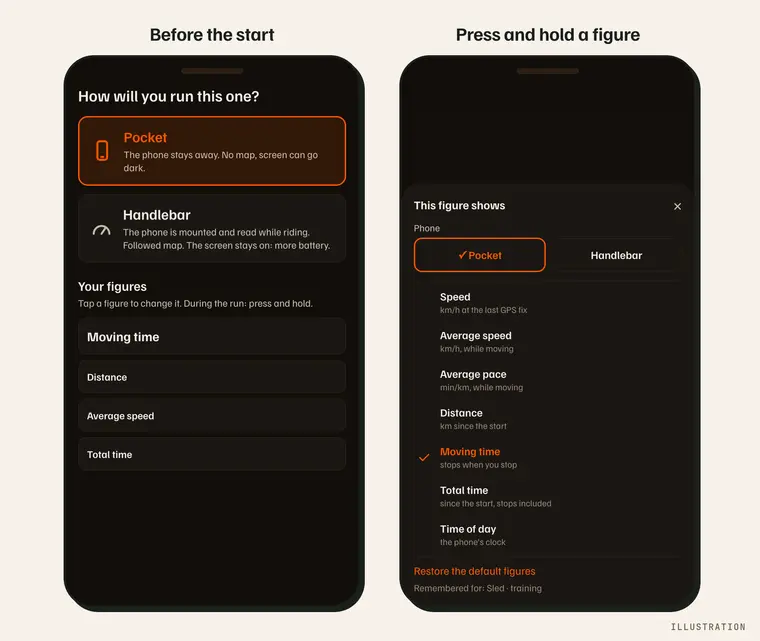
Illustration: on the left, the “How will you run this one?” step with the “Pocket” and “Handlebar” cards; on the right, the “This figure shows” sheet opened by pressing and holding during the run.

  • Pocket: phone put away; the screen goes dark as usual.
  • Handlebar: phone mounted, map followed; the screen stays on while recording (it sleeps again during a stage and at stop): more battery.
  • Light or dark map: the map is dark by default, to save battery. In bright sun, tap “Light map” at the top left of the map (Handlebar, or the map opened in Pocket); the choice is remembered on this phone, for outings and races alike, and can also be changed in Manage › Account and device › This phone (“Dark map on the trail”).
  • Full-screen map: tap “Full screen” at the bottom right of the map (Handlebar, or the map opened in Pocket) to scroll the terrain; “Recentre” brings it back to you, and your figures stay at the bottom. STOP isn't there: tap “Back to figures”, or the screen goes back by itself after 30 s without a touch.
  • The mode is suggested from the activity; your last choice is remembered for each activity and each kind of start (training, sprint race, long race), on this phone. “Start now” leaves with that choice.
  • The figures follow the activity, not the mode: before you leave, “Your figures” shows the run screen with sample values — tap a box, then the figure you want among the tiles, or a preset (“Default” goes back to the activity's own); during the outing, press and hold a figure to open the same tiles, with the current value — and the same sheet switches between Pocket and Handlebar on the way.

The GPS indicator: states and accuracy in metres

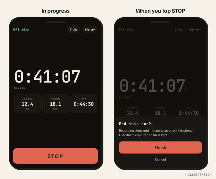
An indicator stays visible while recording, with the current accuracy in metres.

Illustration: on the left, the run in progress with the “GPS · ±5 m” indicator and the “STOP” button; on the right, the “End this run?” sheet.

  • States: active, paused, warming up, searching, imprecise, lost…
  • The detail of each state, and what to do about it: the GPS FAQ.

Send my position

During an outing or a race, “My position” sends where you are to the person you choose: a long press, a confirmation, then the phone's share sheet (SMS, WhatsApp…).

  • Where: in the top bar, next to the GPS indicator, only while recording.
  • A tap sends nothing: it reminds you “Press and hold to send your position”. A long press opens “Send my position” with the exact text that will be sent; only “Send” opens the share sheet.
  • The text: the coordinates in plain figures (readable by SMS with no mobile data), a Google Maps link, the accuracy in metres and the time of the last GPS point with its age (“taken 7 min ago (14:02)”). A position older than 2 minutes is flagged at the top of the confirmation; an accuracy of 500 m or more adds “Approximate position”.
  • With no GPS point yet (the very start of an outing), the confirmation says so and offers no “Send”.
  • What it doesn't do: call emergency services — in an emergency, call 112; follow your position continuously; include the battery level. Outside an outing, the button isn't there.

Going further